Un-Manned Space Vehicles and Near Earth Programs
Satellites Orbiting Earth

Aura
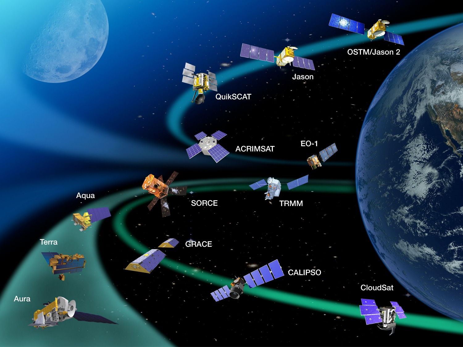
Aura (Latin for breeze) was launched July 15, 2004. Aura is part of the Earth Science Projects Division; a program dedicated to monitoring the complex interactions that affect the globe using NASA satellites and data systems. The major missions for Aura is the study of the ozone layer which protects the Earth from the ultraviolet rays. This mission will help determine the effects of mans actions on the Ozone layer.
Terra
NASA launched the Earth Observing System's flagship satellite "Terra," named for Earth, on December 18, 1999. The Terra mission has been to collect data about Earth's changing climate. Sensors aboard the satellite study the connections between the Earth's atmosphere, lands, oceans, and radiant energy. The special design of the sensors enables scientists to conduct experiments and gather data based on specific scientific objectives.
GRACE
The Gravity Recovery and Climate Experiment (GRACE), a joint mission between NASA and the German Aerospace Center, was launched in 2002 is making detailed measurements of Earth's gravity field. The measurements are accomplished by measuring precise changes between the twin satellites and the variations in the mass of objects on the earth's surface.
Calipso
The CALIPSO satellite is a joint venture between the US and France. It was developed to help scientists answer questions and collect data about the effects of clouds and aerosols (airborne particles) on changes in the Earth's climate. Understanding how these materials travel around the globe will help the scientist community develop a better understanding of how these materials affect the Earth's climate. With this information national leaders can discuss and make more informed policy decisions about global climate change.
CloudSat
The Cloud Sat and CALIPSO Satellites were launched together from Space Launch Complex 2W at Vandenberg Air Force Base, California, on April 28, 2006. The mission of the Cloud sat satellite was to collect data on Clouds. Clouds have a huge influence on our weather and climate. Clouds and their affect on the Earth's hydrological cycle are important in making weather predictions.
Aqua
Named for the Latin meaning of water the Aqua satellite mission was launched May 4, 2002. It collects eighty-nine (89) Gigabytes of information about water around the earth each day. It measures water as a liquid (oceans, rivers and lakes), solid (in the form of ice), and vapor in the forms of clouds. Amazing is that it can also detect water in land masses and dissolved materials in the ocean while also comparing temperatures.
SORCE
SORCE was launched by NASA January 25, 2003. The Sorce mission is to collect data about x-ray, ultraviolet, visible, near-infrared, and total solar radiation hitting the earth. The mission combined the EOS Solar Stellar Irradiance Comparison Experiment (SOLSTICE) and the Total Solar Irradiance Mission (TSIM) satellites. The SORCE mission uses its data to look at long-term climate change, natural variability, climate prediction, and information on atmospheric ozone and UV-B radiation. These measurements are used to study of the Sun, and its effect on our Earth, and how it affects mankind.
EO-1
The Earth Observing One (EO-1) Satellite was launched on November 21, 2000. EO-1 is the first Earth observing platform of NASA's New Millennium Program (NMP). The NMP develops new technologies and strategies for improving the quality of observations. The improved imaging quality has enabled NASA to sell this information to other government and public agencies. EO-1 enables users to obtain specific data via its Sensor Web Vision web-page, for a fee. Various international groups use the data obtained form EO-1. The Committee on Earth Observation and Safety (CEOS) use the data to create plans to react to disasters on Earth.
QuickSCAT
NASA's Quick Scatter meter (QuikSCAT) was launched into space June 19, 1999 by the U.S. Air Force atop a Titan II rocket. The Quick SCAT was a joint mission between NASA and the National Ocean and Atmospheric administration. The mission observed the wind speed over the oceans. The Quick SCAT satellite was able to collect data of the winds over the oceans in strips of 1800 kilometers (1118.468 miles). The mission was to last only three years (3) but the satellite is still is in use today.
Jason
The Jason 1 (Ocean Surface Topography Mission) was launched on Dec. 7, 2001. NASA and the French Space Agency, Centre Nationale d'Etudes Spatiales (CNES) got together on this project. This mission was a three-to-five-year mission to study Earth's ocean from space. Jason-1 is still in use today providing data on the ocean's surface and depths. The mission also continues to enable scientists to investigate and see circulation patterns in the oceans and their effect on climate change.
Jason 2
Jason-2 Ocean Surface Topography Mission (OSTM), was launched on June 20, 2008 and continued the relationship between the French Space Agency, Nationale d'Esudes Spatiales (CNES) and NASA. The Jason 2 mission continues the Jason-1 mission to map and collect data on the oceans topography. With the information scientists will continue to monitor global ocean circulation, and discover the links between the oceans and atmosphere. This can help them improve global climate predictions. The accuracy of the enhanced technology on board should be of about 1 cm on the altimeter as well as the orbit measurements.
An unprotected human can survive up to 1.5 minutes in space with no permanent bodily damage.